

As the leaves begin changing, every Northeasterner must embark on a pilgrimage to New England to observe the changing foliage. The issue most folks are facing is deciding when to go. The leaves can be quite unpredictable, allowing only for a relatively short window of peak color, before they unceremoniously turn brown and fall off. Late September or early October are good times to go. Keep in mind the season usually concludes around October 10 when many New England tourist attractions shut down.
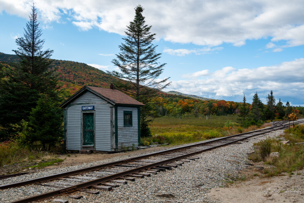
Day 1 – Monday – Departure and Lowell, MA
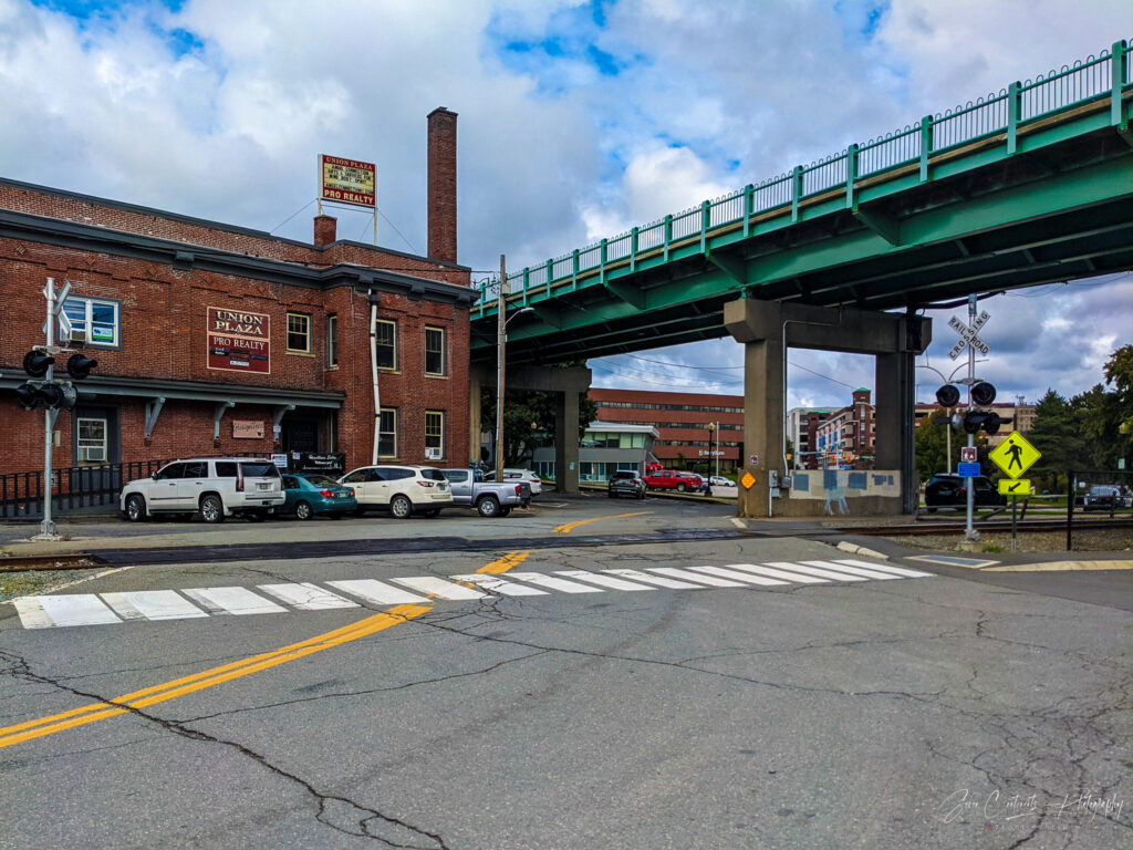
The first segment of my trip takes me to Lowell, MA. Lowell is an industrial turned university town on the Merrimack River close to the New Hampshire border. I was hoping to get here early to see the town but it was not meant to be. As always, I had packed at the last moment. I did not leave until 2pm and ran into the usual traffic around NYC and in Connecticut. It did not help that Google Maps was picking the worst routes. It is 7pm by the time I pull up at the UMass Lowell Inn & Conference center.
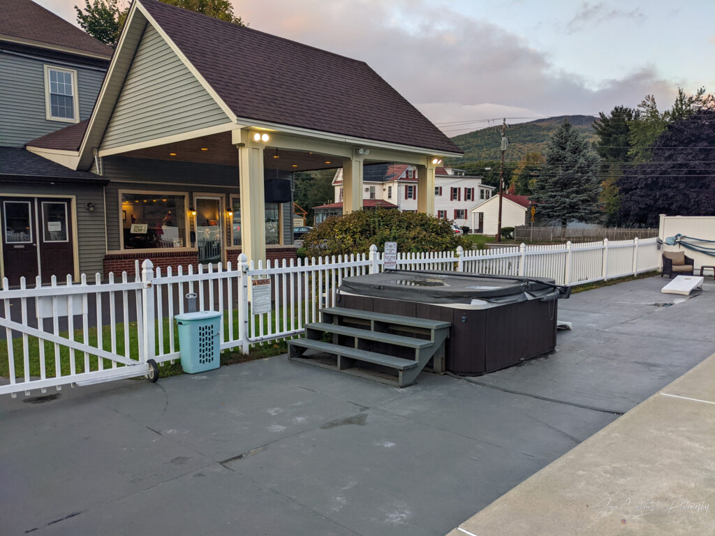
The Hotel
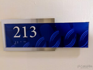
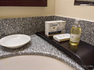
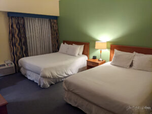
There are not many hotel choices in downtown Lowell. The UMass hotel was reasonably priced, centrally located, and included free parking. Most of it appears to serve as a student dormitory and you cannot escape the college vibes of this place. I actually enjoyed the atmosphere, reminiscing on my own college days. The room was well appointed with two queen beds, a refrigerator, and a full set of toiletries. My room was on the second floor, just up a flight of stairs from the lobby. Normally, I am not a fan of low floors, but not having to use the elevators was a bonus. Another bonus was the view of the Pawtucket Canal and Lower Locks, a historic set of locks linking the Pawtucket Canal and Concord River.
Lowell after Dark
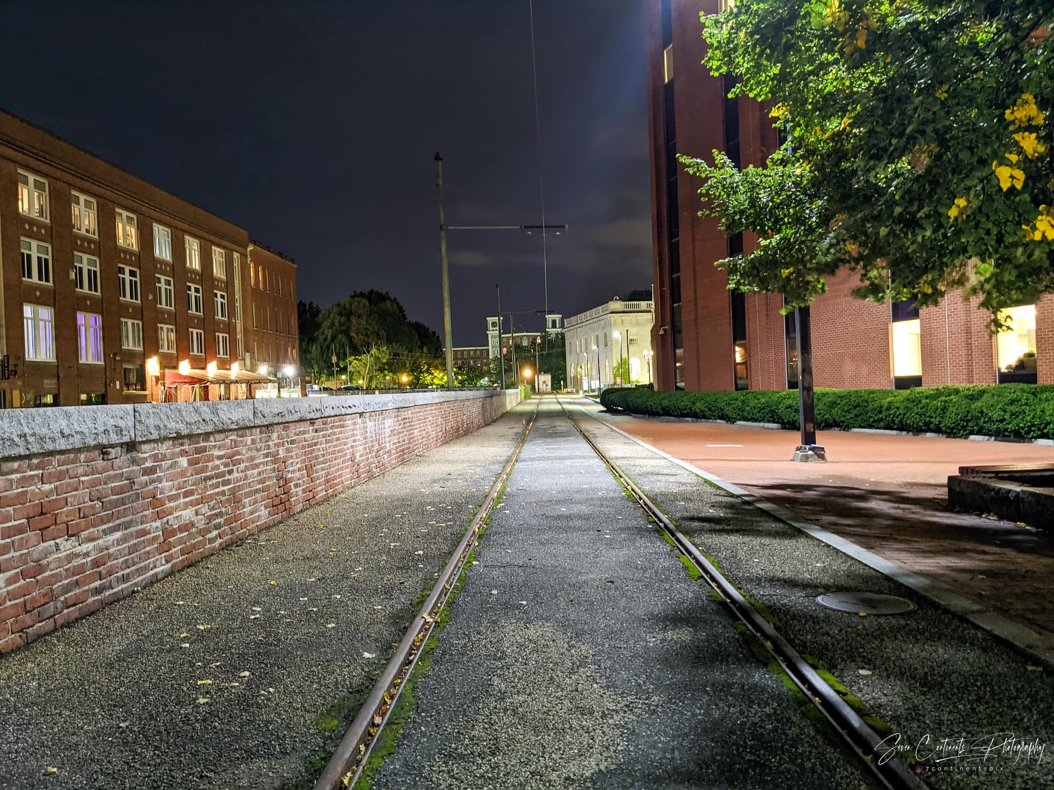
It is too early to go to bed, so I venture out to see the city after dark. Thanks to the hotel’s central location, all historic downtown is a short walk away. However, Lowell after dark is anything but a bustling college town. Apart from a guy walking his dog, the downtown area was largely empty, it almost seemed eerie. Then again, people typically don’t go out on a Monday night. I take a two hour stroll around the locks and canals, while charging my car at a free EV charger near the hotel. I did not expect Lowell to have this much history. Canals built to power old manufacturing mills and to navigate around Pawtucket Falls are everywhere. I learn that, back in the day, the canals earned Lowell the nickname Venice of America.
Day 2 – Tuesday – Lowell to Acadia
Experiencing Lowell
Before heading on to Maine, I want to see the Venice of America during daytime. I get up early and venture out to see the city. This time, it presents a much livelier picture. Students are heading to class, people are heading to work, the previously deserted streets are buzzing with life. The weather provides a dramatic backdrop with ominous dark clouds and intermittent roars of thunder. As long as it does not rain, this should be a quit breezy walk that will take me through the canal district to Pawtucket Falls and back to the hotel.
The Venice of America
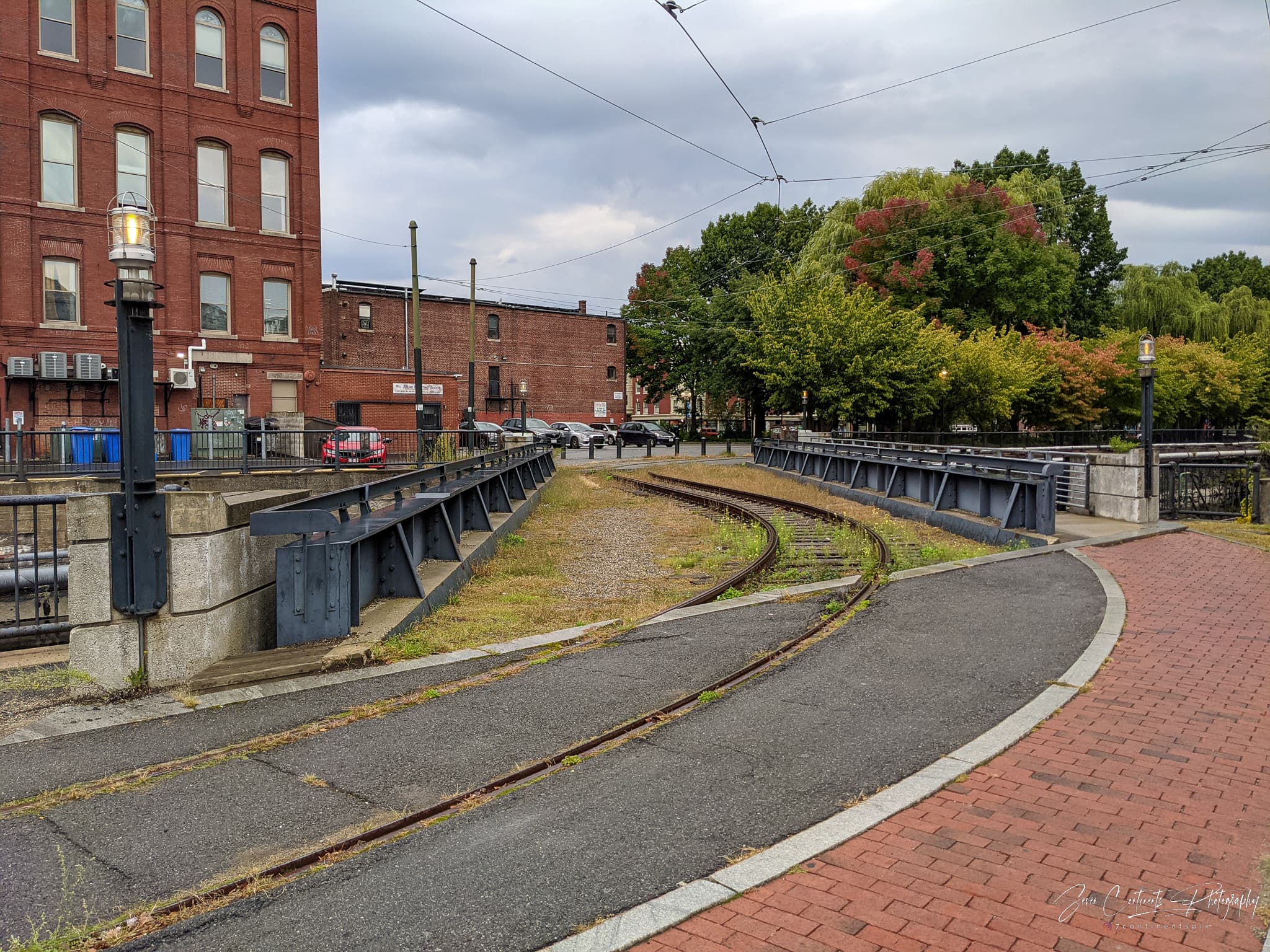
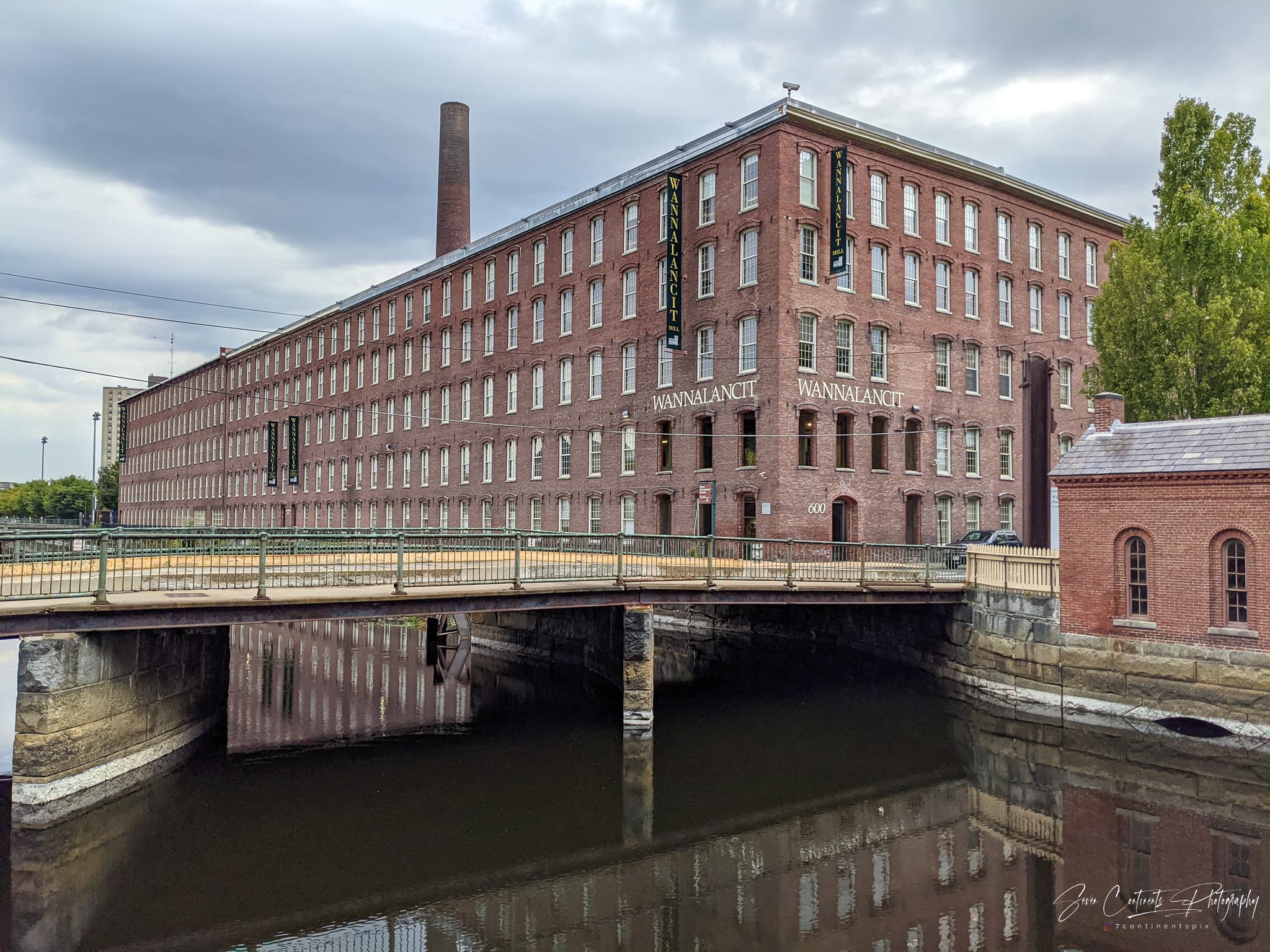
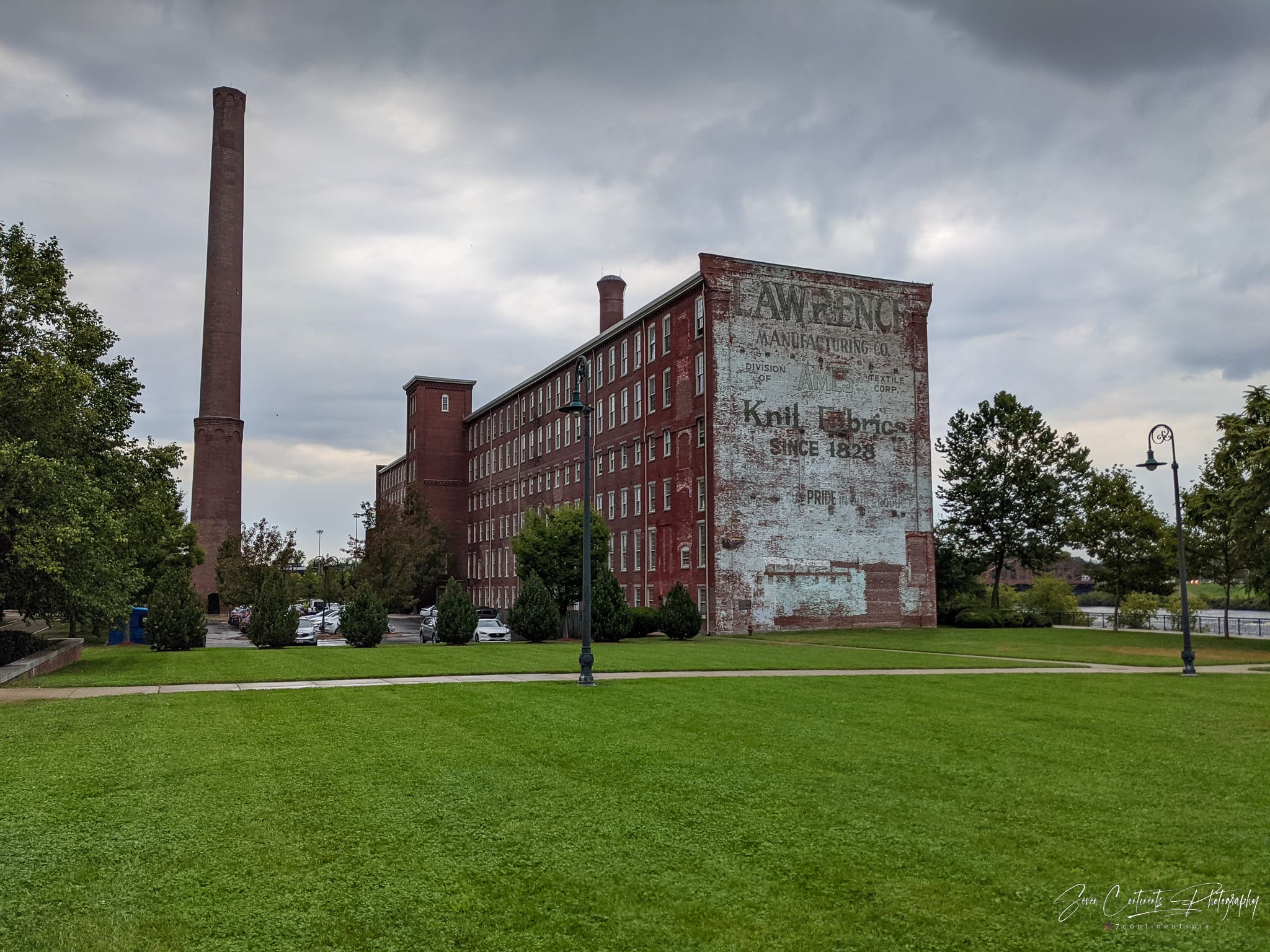
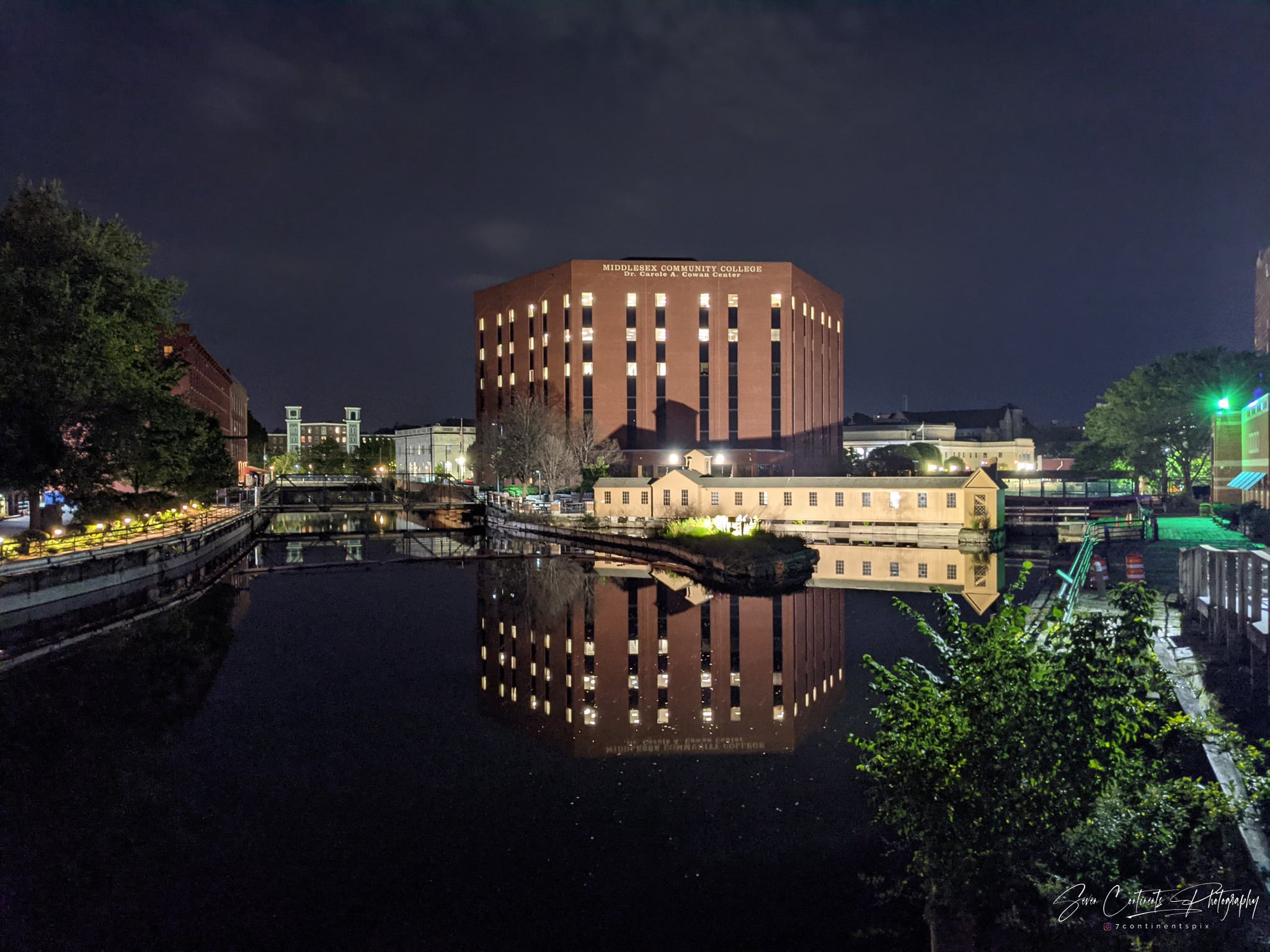
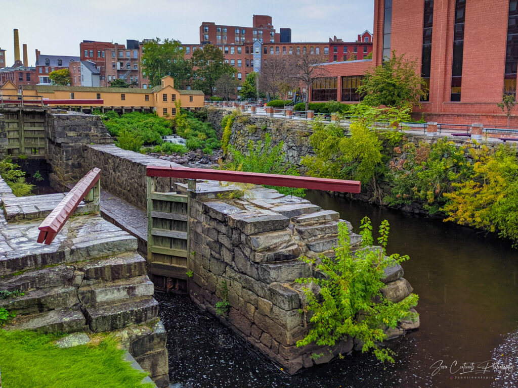
The name Venice of America is a bit of a misnomer. The canals here clearly served a different purpose. Do not expect romantic gondola rides. These canals were built to power the many cotton mills that make up the entirety of downtown Lowell. Today, these former mills serve as offices, apartments, and house UMass Lowell. I walk along French Street and Father Morissette Boulevard which takes me past some of the largest factories: First Boot Mills, now a museum, shopping and apartment complex. Then Wannalancit and Lawrence Manufacturing, both former cotton mills that now house the University of Massachusetts.
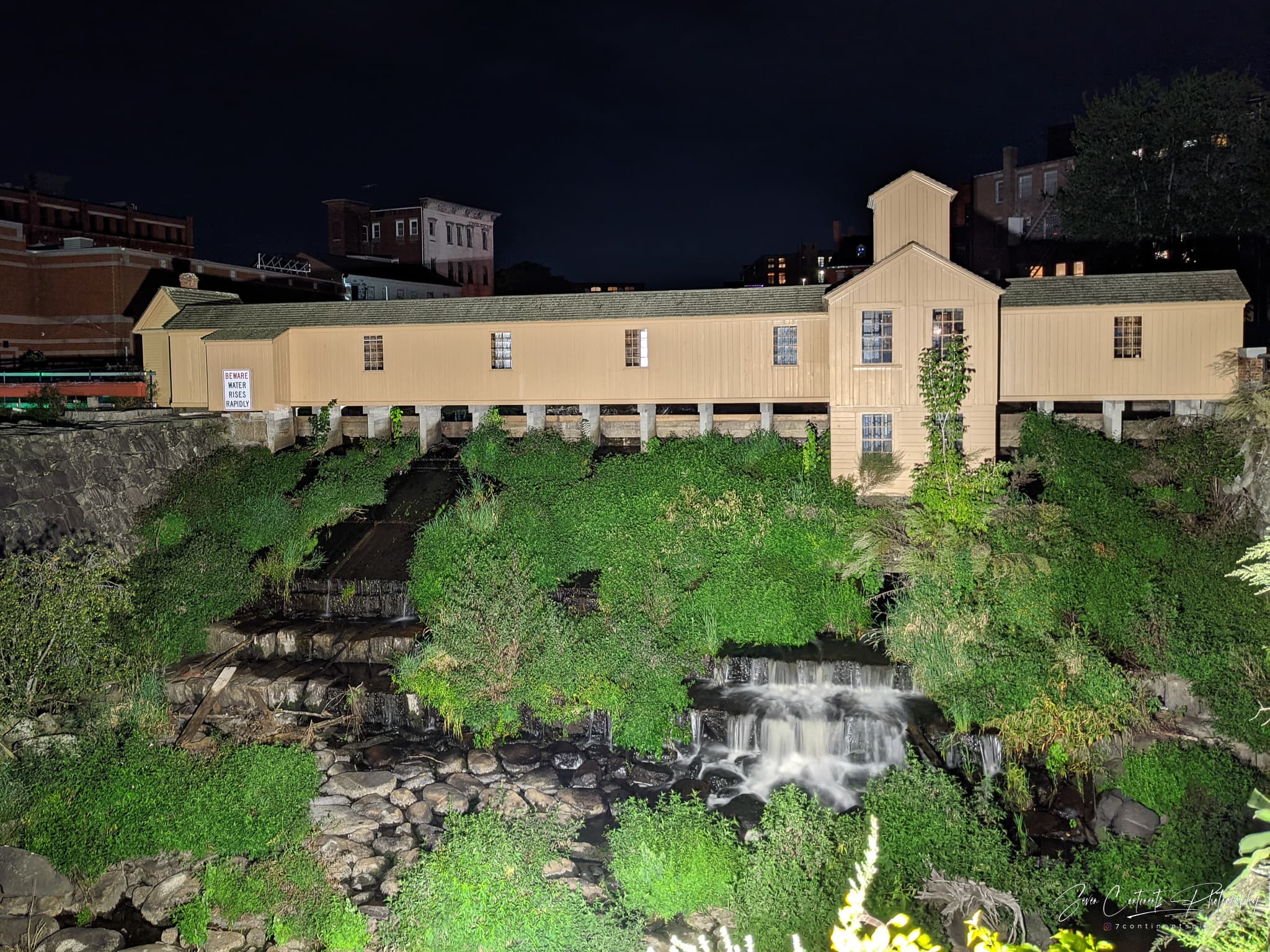
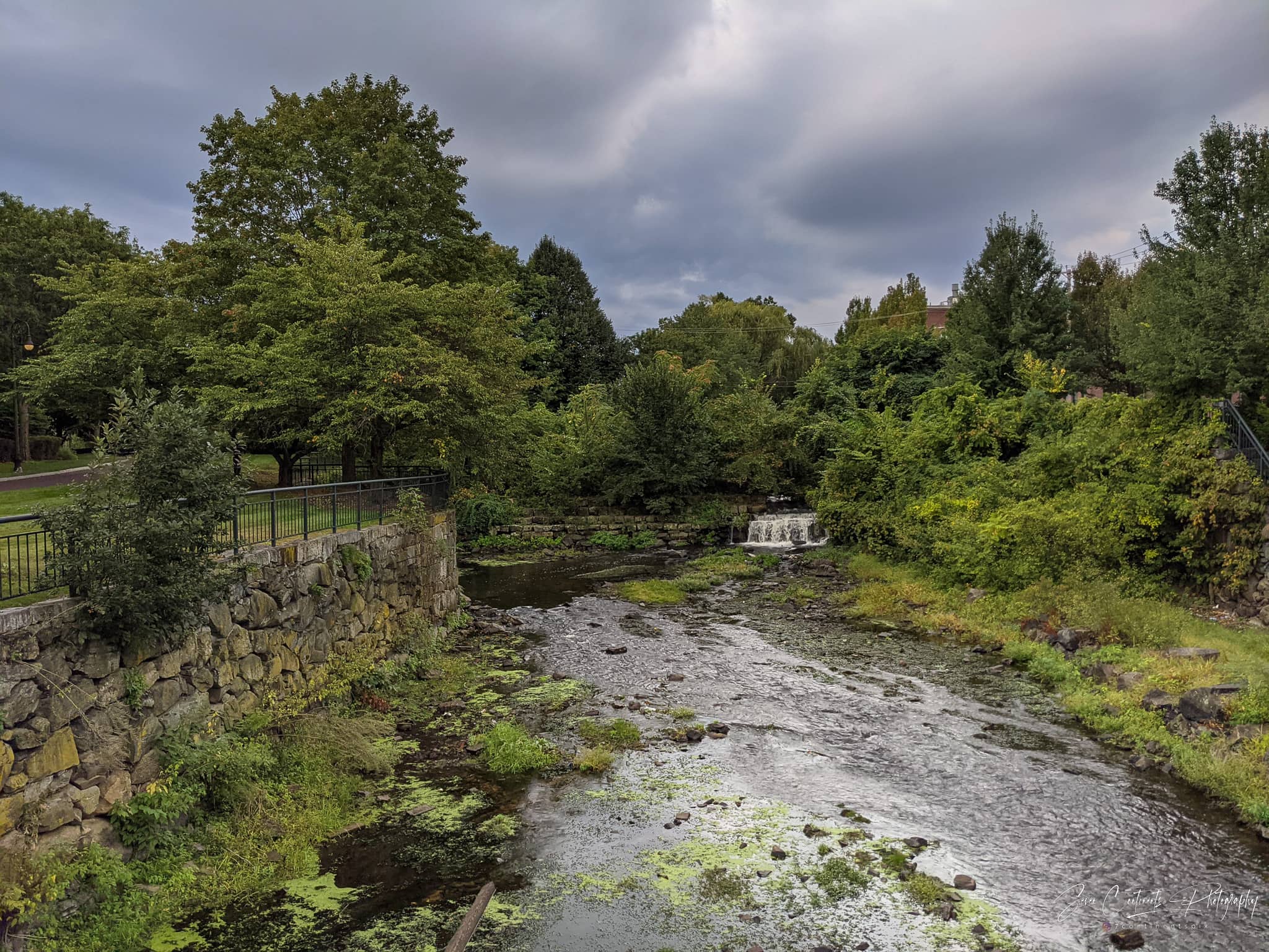
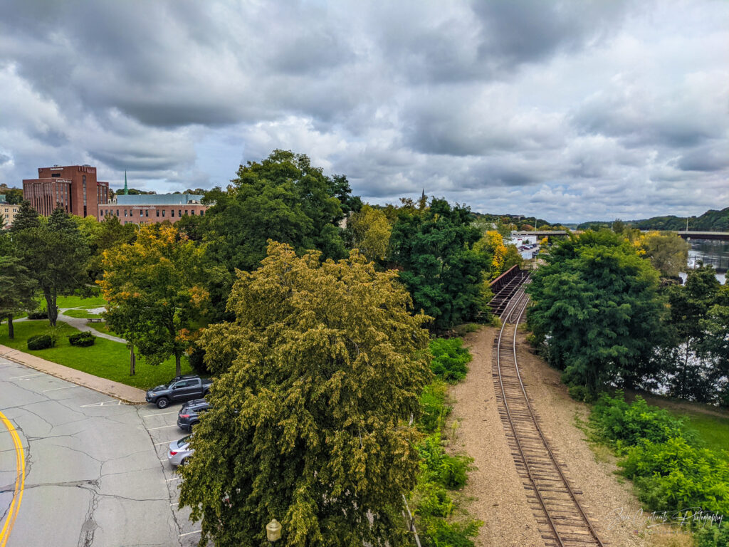
The industrial buildings are well-preserved. In fact, they probably look better today than they did when soot and smoke from the smokestacks blanketed the city. I cross a picturesque stream running through the remnants of a dam to make my way to the river walk along he Merrimack River. The stream is the Lawrence Wasteway, a canal that used to drain water from the canals into the river. I can’t help but wonder what the water looked like back in the day. Today, it is clear and reportedly great for fishing.
Pawtucket Falls
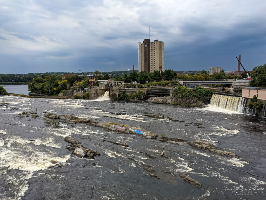
A finally make it to Pawtucket Falls. The falls are slightly disappointing. Do not expect a roaring waterfall. Pawtucket Falls look more like rapids, largely tamed various dams and canals. On my way back to the hotel I walk along the Northern Canal which rungs alongside the old Wannalancit Mill. I notice the several water intakes that allowed the mill to take in water from the canal.
Sadly, the museum inside is closed, so I can’t see how the little canals entering the building used to power machinery on the inside. The mills used to pay a fee to the Proprietors of Locks and Canals for the water they used, financing the canals’ upkeep. I would like to explore more, but it is starting to rain and I have a long drive to Acadia ahead of me. I head back to the hotel, check out at 11, and hit the road.
Driving to Acadia

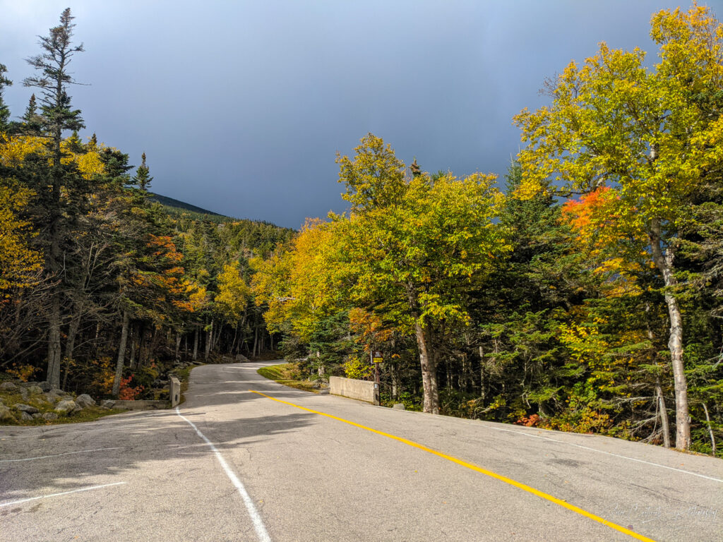
The drive to Acadia takes me past Portland and Bangor, ME, which would have been great places for a pit stop. Alas I am on a tight schedule because I need to buy a park pass before 4:30pm when the visitor center closes, check into the Sewall Campground, and then head to the Cadillac Mountain Road for my 5:30pm reservation. The weather is rainy but starts clearing up by the time I reach Maine.
With only a quick fuel and food break, I finally make it to route 1A, which connects Bangor with Ellsworth near Acadia. The road is mostly two lanes and traffic is heavy, putting my tight schedule in jeopardy. From Ellsworth, rather than taking Route 3, the main road into Acadia, I take a side road in hopes of saving some time. Whatever time I saved was worth it because I arrive at the visitor center at 4:28pm just as the park ranger is lowering the flag on the flagpole. I buy a $80 America the Beautiful pass and head over to the campground, 30 minutes away.
The Seawall Campground
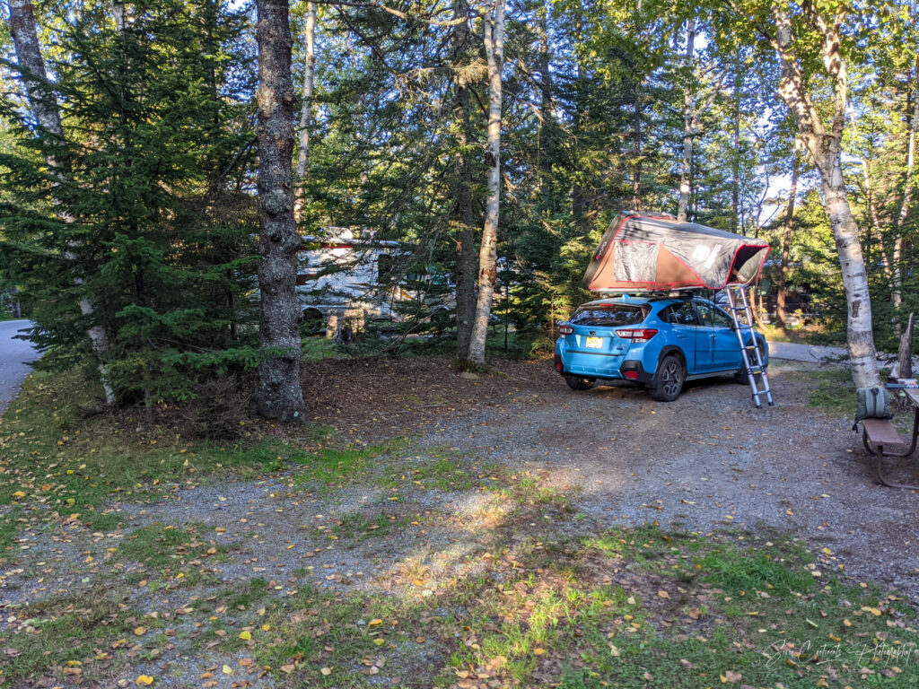
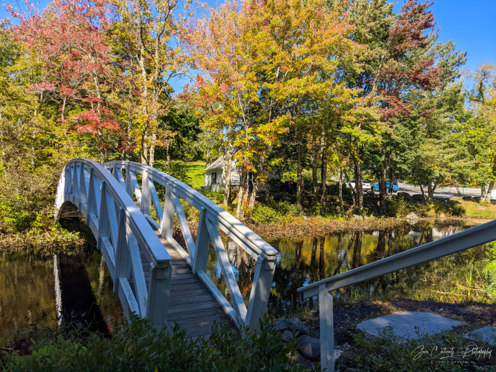
Like all official park campgrounds, Seawall is fully booked and requires advance reservations. Fortunately, I was able to snag a site just two days prior. The ranger at the entrance checks my reservation, my park pass, and gives me a map directing me to my camp site. I had to book an even more rare RV site because my tent sits on top of my car. Somehow, the NPS requires all tents to be placed on the ground. Sleeping in or on top of a vehicle makes that vehicle an RV.
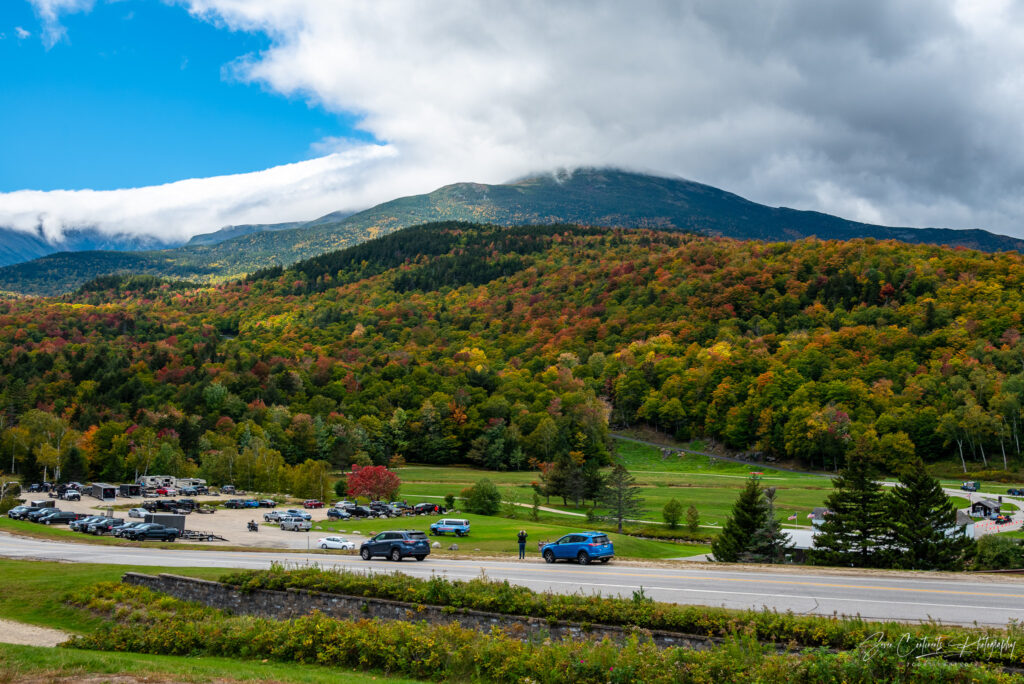
Cadillac Mountain
Reservations Required
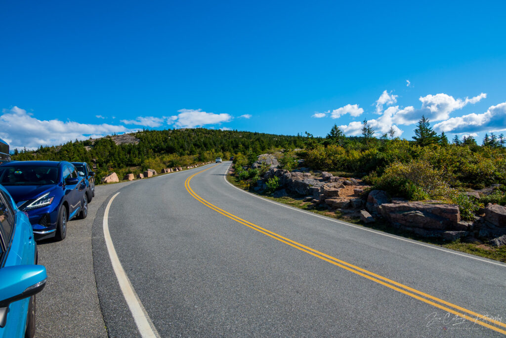
Cadillac Mountain is meant to be today’s highlight. It is by far the most popular spot in Acadia and no visit is complete without seeing it at least once. It is so popular that during summer and fall season it requires a $6 reservation. The ticket gives you a 30-minute window during which you may pass the summit roads toll booths. There are many signs alerting drivers to the reservation requirement, which does not stop people from trying their luck regardless. But the park rangers are strict and turn around every car in line in front of me. When it is my turn, I present my ticket and I am good to go. Note that the tickets are digital, available through the recreation.gov app, which does not work at the base of Cadillac Mountain due to no reception. Be sure to screenshot the ticket before heading up!
Alpenglow

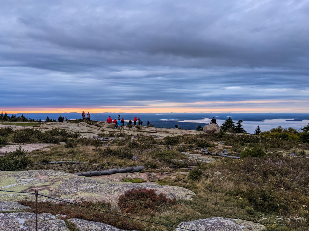
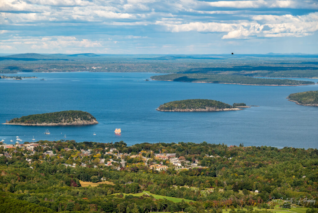
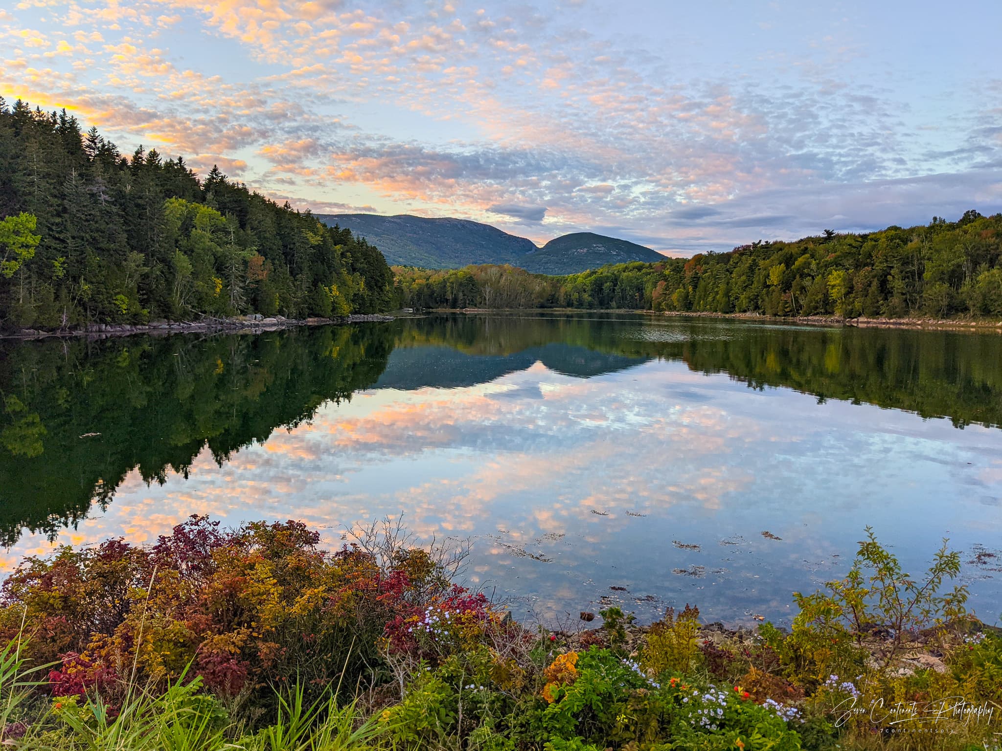
The drive up Cadillac Mountain takes you up a narrow, windy road that takes you past several small parking areas that allow you to stop and take in the vistas along the way. There is a larger parking lot at the top which is remarkably almost full. I begin to appreciate the need for a reservation system. Everyone came to the mountain to watch the sunset but cloudy skies dashed everyone’s hopes. The atmosphere at the summit is nevertheless a happy one. Everyone is taking pictures and soaking in the evening views of Bar Harbor and the Mt. Desert Narrows. Just after sunset, mother nature does have a pleasant surprise for us. The horizon is illuminated in a beautiful orange alpenglow, bringing the day to a picture-perfect end.
Day 3 – Wednesday – Exploring Acadia
Checking Out
Camp checkout is at 10am, but I decide to leave early. Sleeping in a tent, even a rooftop one, in an RV site is not great. The site offers little privacy, the neighbors seem bewildered by a car taking up a 35ft pull through site, and the gasoline smell from generators permeates the area. Before 8am, I drop off my camping tag a the express checkout box and head to the Seawall Picnic Area to have breakfast. If you are a very early bird, the Seawall area is one of the first areas in the U.S. to catch the sunrise.
Bass Harbor Head Lighthouse
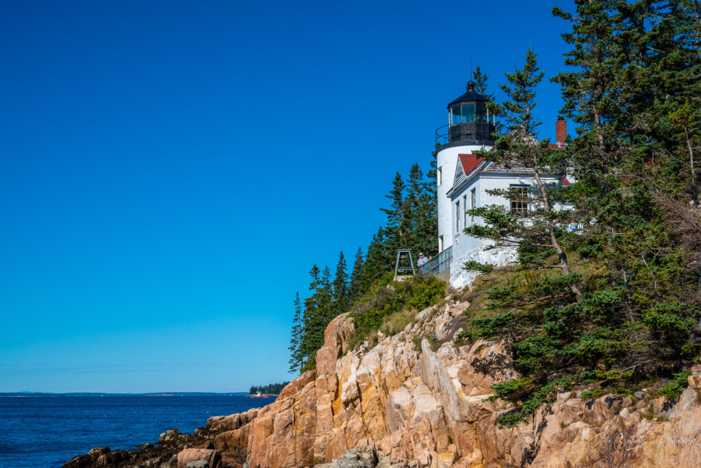
I love lighthouses so it should surprise no one that this nearby lighthouse was first on my list. I get there just before the crowds do, catching one of the last coveted parking spots. The lighthouse sits perched on top of cliffs at the southern tip of Mount Desert Island. It is the only lighthouse on this island, built in 1858. At first I take the easy trail that takes you to the front of the lighthouse. But because of trees, you can’t actually see the lighthouse very well from this vantage point. I take the second trail that takes you down the stairs right onto the rocks below the lighthouse. If you feel adventurous, you can climb down a bit further for a perfect view of the light house.
Cadillac Mountain – Take Two
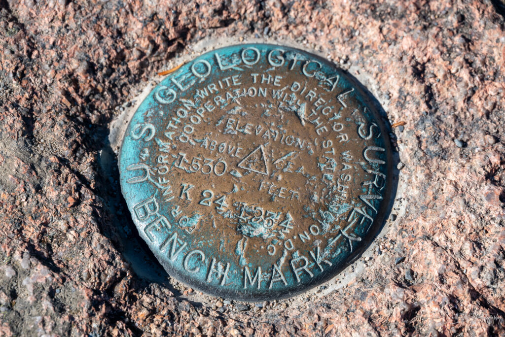
I had made another reservation, this time for 1:30pm, to get a daytime view from this famed peak. After the now familiar ascent, I start searching for the true summit. Everyone climbs the rocks around the parking lot, thinking they are at the summit, but as it turns out, the true summit is somewhere else. I take the path past the gift shop that opens up to another rocky area. Here I find the official marker indicating the true summit of Cadillac Mountain. Ironically, unlike the fake summit a few hundred feet away, this area is deserted. I have Cadillac Mountain to myself.
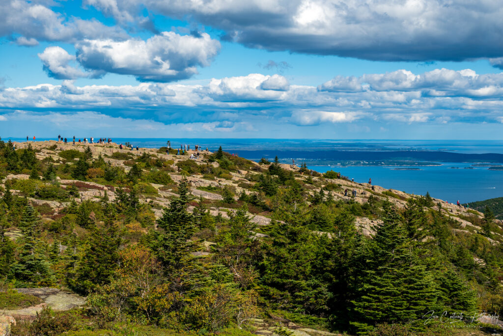
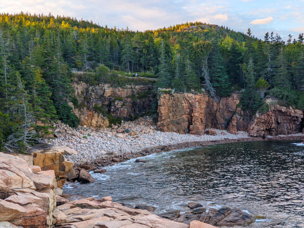
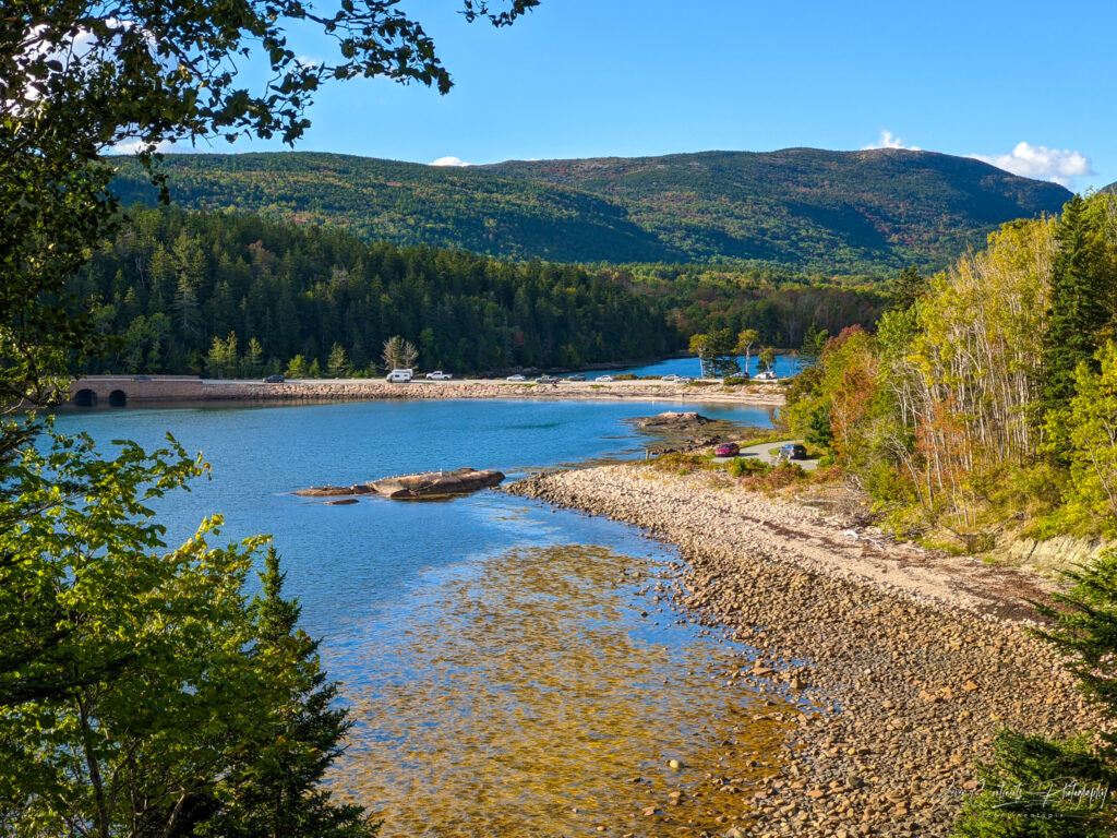
Park Loop Road
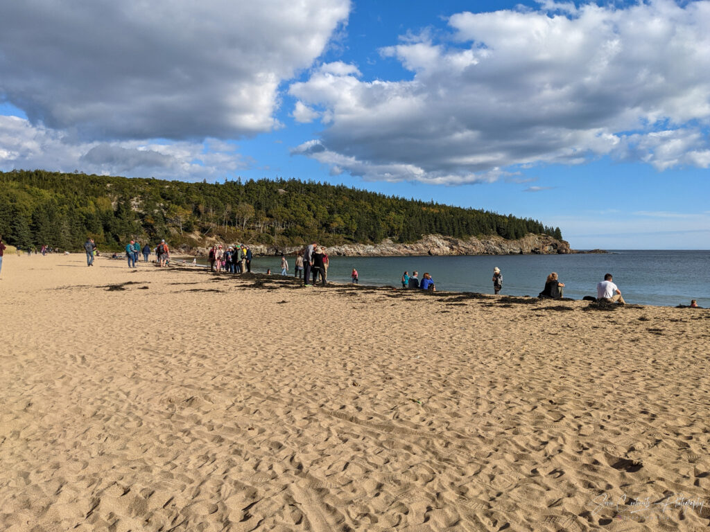
The road from Cadillac Mountain connects with the Park Loop Road, which, as the name suggests, loops around the national park. Acadia is quite small, so you can see all the main sites in just a day. The Loop Road takes me past Egg Rock Overlook, from which you can see Egg Rock Lighthouse on an island in the distance, Sand Beach, the only sandy beach in the area, and Otter Cliffs. You can buy a rock climbing permit permit for Otter Cliffs, but I am not that adventurous. Instead, I just sit back and listen to the surf crashing against the cliffs.
Blackwoods Campground
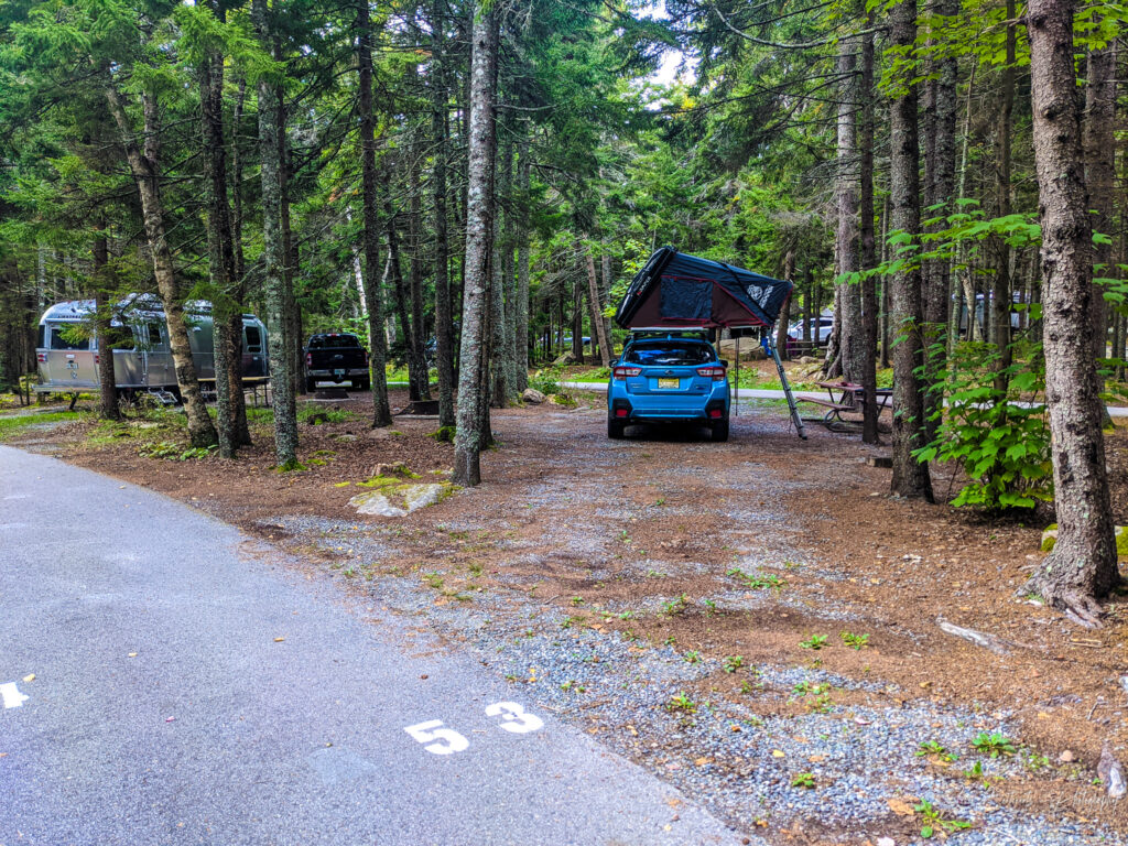
It’s not time to check into the second campground on my trip. A site had just opened up a day prior, so I was lucky to book another RV site. Unlike Seawall, Blackwoods offers cell phone reception and seems to attract a more affluent crowd. I park my car between late model Airstreams and conversion vans. Unfortunately, the campground does not offer showers or electricity, so you have to deal with people running generators during the hours when generators are permitted. There is a private coin operated shower outside the campground that takes a whopping 12 quarters for four minutes of water.
Biking Acadia
Bringing a bike to Acadia seemed like a great idea considering the park’s smaller size. Unfortunately, I immediately learn that the park is not very bicycle friendly. The campground has a path that leads directly to the ocean and to the Loop Road, but the Loop Road is one way only. And the main attractions are all against the flow of traffic. To get to the famous Thunder Hole, only a few miles away, would involve biking the entire 27-mile loop. That’s not very practical, especially as it is already 5pm. I need to find another way.
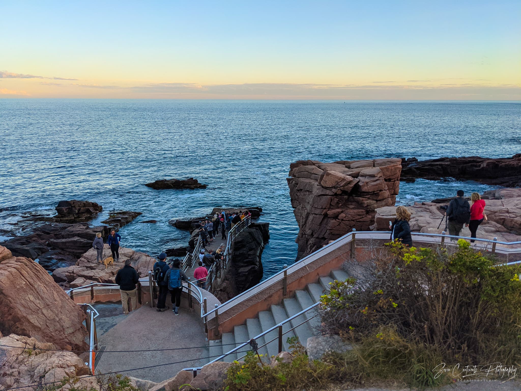
The Thunder Hole
Route 3, the busy and hilly thoroughfare to Bar Harbor, takes me to Otter Cliff Road. That road takes you to, you guessed it, the Otter Cliffs I mentioned earlier, just south of the Thunder Hole. From there, I can walk my bike a few hundred feet to the stairway that takes you down to the Thunder Hole. The Thunder Hole is a small underwater cavern that Google Maps describes as a “rock crevice with a pounding wave action.” I couldn’t have found a better description as that is exactly what it is. As the waves roll in, they enter the small cavern, fill it up with water until it is full, at which point the surplus water shoots out to a thunderous roar.
Bar Harbor
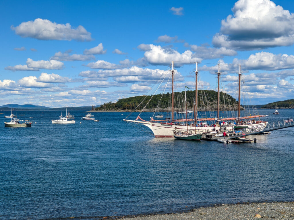
No visit to Acadia is complete without visiting Bar Harbor, the quaint fishing town named after nearby Bar Island. I leave my bike back at the campground and take a quick drive into town. If you come during the season, finding parking can be a nightmare. Thankfully, one of the two EV charging spots on Newport Drive, is available, at a cost of $4 per hour (free after 8pm). I pay the fee and go explore.
Tidal Adventure
Bar Harbor is famous for the tidal land bridge that connects it to Bar Island at low tide. You have a three hour window during which you can walk over to Bar Island and back. Otherwise, plan for an involuntary 9-hour stay on the uninhabited island. If you feel particularly adventurous, you can drive your car to Bar Island but not on the island itself. But if you get stuck, your car will be a total loss. Alas, I am too late to make the crossing either way as the tide is coming in. I decide to tour the town instead.
Main Street
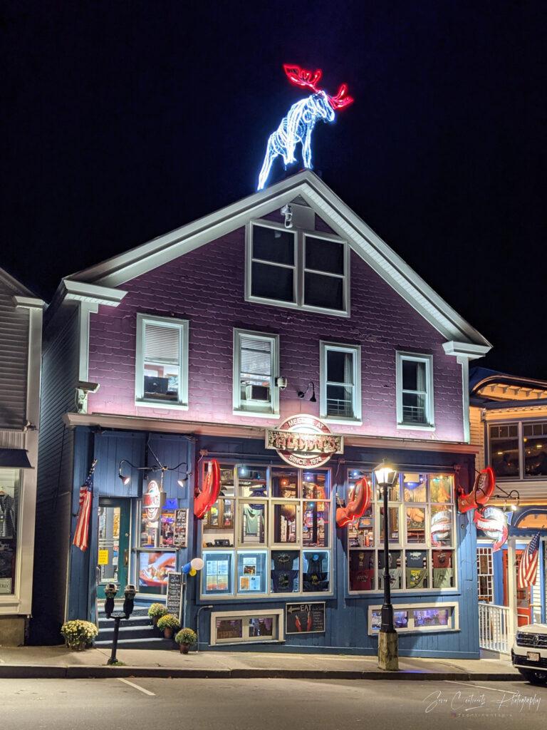
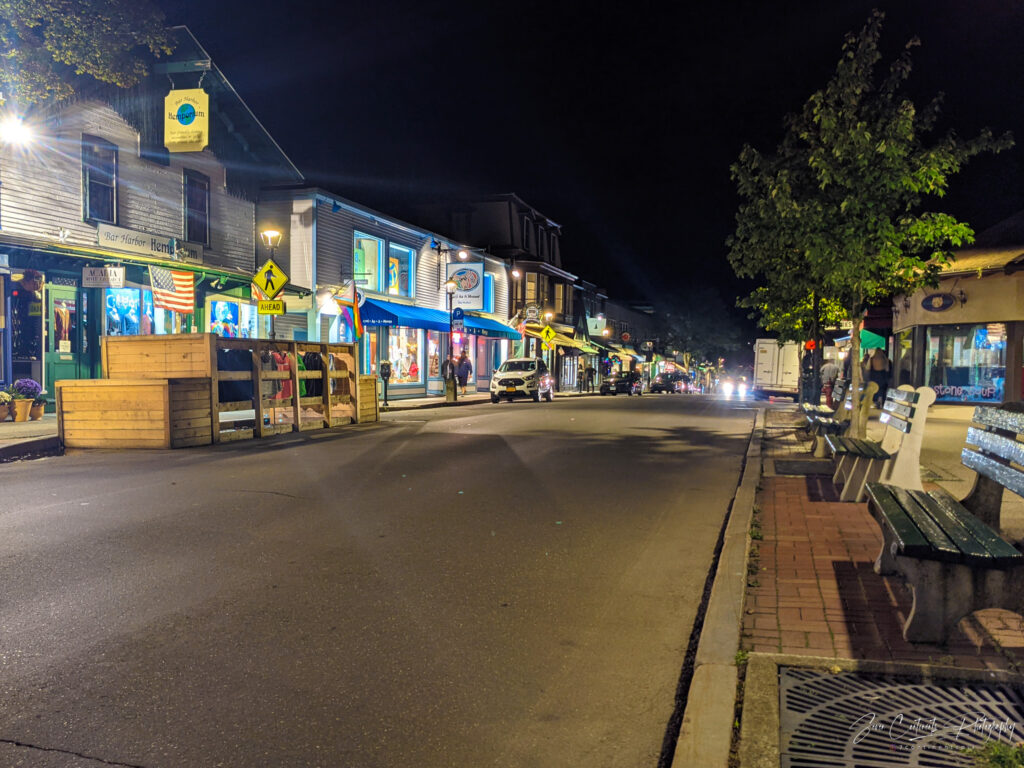
Downtown Bar Habor is very walkable. Most of the action is centered around, you guessed it, Main Street, dotted with restaurants, souvenir shops, and antique stores. As you would expect, the restaurants are all about seafood. If you are not a big fan of seafood, don’t tell anyone and find a sandwich shop like I did. Even though it’s late in the season, Mains Street is quite packed. But people around here like to dine early. Once it hits 9pm, the streets are nearly empty. By 10pm, the town seems deserted, so I head back to the campground to set up for the night.
Day 4 – Thursday – Goodbye Acadia, Hello White Mountains
Today’s plan is to leave Acadia behind and drive to New Hampshire to visit Mt. Washington and the White Mountains. I had planned on doing a little more sightseeing in Acadia, but it is raining. I pack up, check out of the campground and head to Bangor, Maine, the only planned stop on today’s 4.5-hour drive to Gorham, NH.
A Stroll in Bangor
Bangor is Maine’s third largest city and New England’s northernmost sizeable city. It is on my way, so I might as well stop and check out downtown. Just as I am exiting the Interstate, I run into an enormous funeral procession attended by seemingly everyone in town. I park downtown, check my phone, and find out the procession was for Sherriff Deputy Luke Gross who had been struck by a pickup truck while responding to an accident. With everyone at the funeral, downtown Bangor is virtually empty.
Bangor’s History as a Transit Hub
The riverfront along the train tracks is a great area for a walk and to learn a bit about the history of Bangor as well. The railway bridge over the smaller Kenduskeag Stream running through downtown has only one track but space enough for two. The tracks do not get much use today, but a century ago, Bangor was a busy railway hub. Did you know that the fastest way to get get to New York to Europe was through Bangor? Trains whisked passengers through Bangor to Halifax, NS, where they boarded ships headed for Europe. This provided the shortest possible ocean crossing.
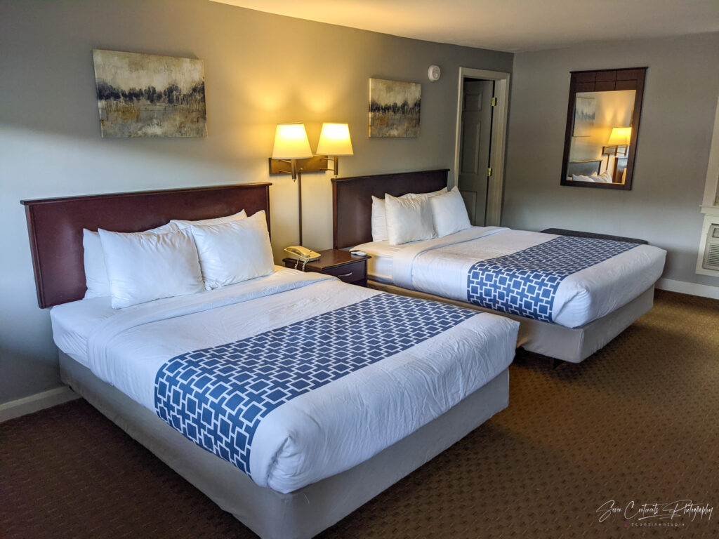
With restaurants and shops closed, it is time to head on to Gorham, NH. Gorham lies far off any major interstate, so even though the distance is not great, it is a long drive that will take me along windy country roads from Augusta, ME all the way to Gorham. I make it to Gorham around 4pm and check into the Mt. Madison Inn & Suites. The hotel is really a motel that has been fully renovated, proving that even a motel can come with up-to-date furniture, clean bathrooms, and contemporary bedding.
Day 5 – Friday – Mt. Washington, Waterfalls, and returning home
Today will be the busiest day of my trip overall. I plan on driving on top of Mt. Washington, hiking to three different waterfalls, concluding with a 7.5 hour drive back home. I wake up early to be one of the first cars at Mt. Washington and have enough time to see everything before heading home.
Mt. Washington
A Piece of Acadia History
Mt. Washington is the tallest peak in the Northeast, standing at 6,288ft (1,917m). It’s a fitting stop on the way home from Acadia because of its relationship with Cadillac Mountain. Mt. Washington is famous for its cog railway that takes visitors all the way to the peak but the railway originally served Cadillac Mountain. Now, a piece of Acadia history lives on in New Hampshire. Sadly, the railway departs from the other side of the mountain, 90 minutes away, so I will be taking the auto road instead.
Worst Weather in the Northeast
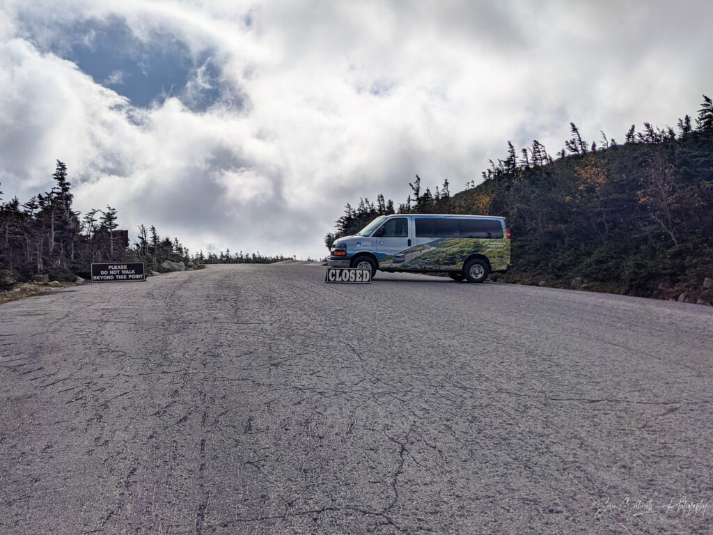
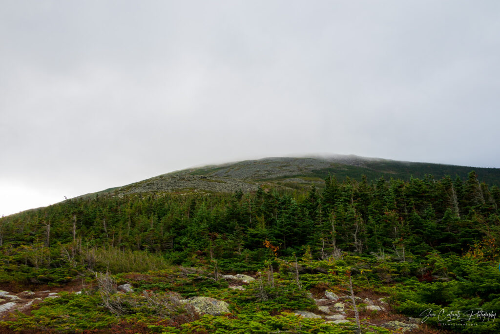
Mt. Washington is notorious for its terrible and unpredictable weather. While it could be warm and sunny everywhere else, the peak is often shrouded in clouds and battered by heavy winds. Today is no exception. The weather at the base is warm and mostly sunny. But as soon as I approach the toll booth, the attendant informs me that it is snowing at the peak, with 75-100mph winds, and that private vehicles would only be allowed to the tree line winter cutoff. As I am already here, I decide to take the discounted $29 toll and proceed to at least the tree line. The attendant hands me the famous “This car climbed Mt. Washington” sticker and I wonder to what extent that is a lie.
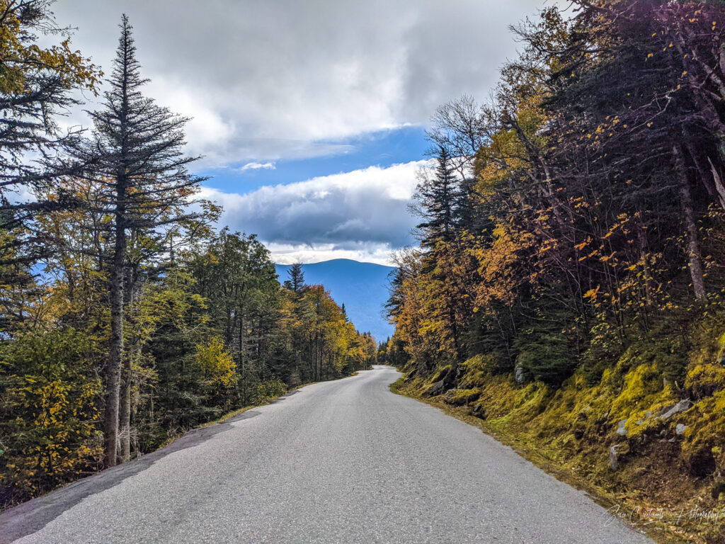
The Auto Road
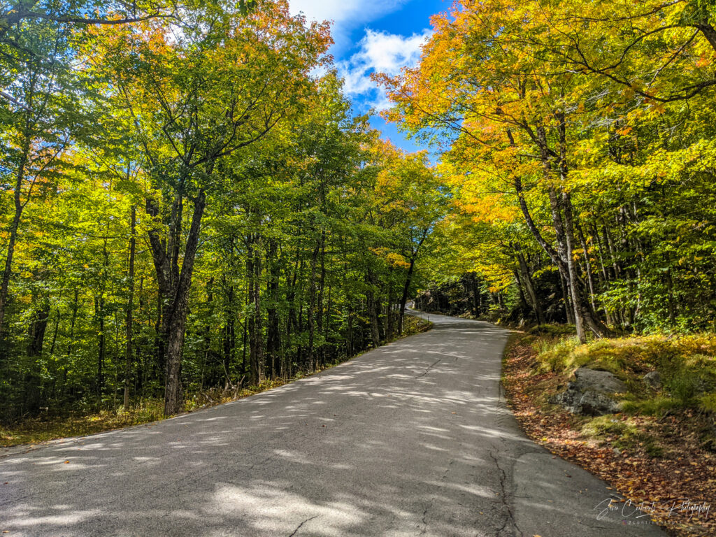
Driving up Mt. Washington involves navigating a narrow, windy road that takes you through distinct climate zones. At first, I am greeted by an explosion of color as deciduous trees are near their peak fall color. As I ascend, evergreens take over and get smaller and smaller in size until I reach the tree line beyond which no trees grow. Beyond the tree line is where the arctic alpine climate and bad weather begin.
Up to The Tree Line
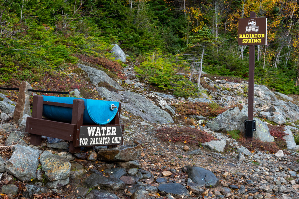

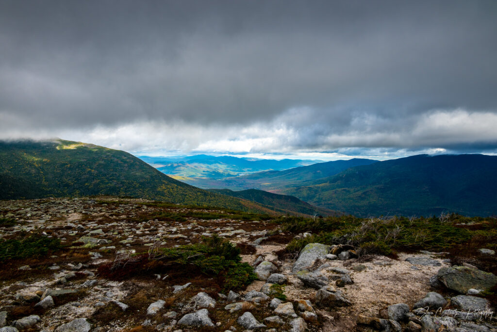
Not far past the tree line, the road is blocked by van. Only organized tours are allowed past this point. Three years ago, I was allowed to continue to the peak despite snow and ice, but this year, they are playing it safe, sealing off the summit to private vehicles. I park my car at a makeshift parking lot just below the clouds shrouding the peak and take in the view. Even at this elevation, just above 4,000ft, the wind is frigid and relentless. As I walk around, I take some pictures, before my ears start to freeze, making me head back to the car to start my descent. Along the way, I encounter a group of people on ATV’s that attempt to show off and rev their engines, until one of them stalls and doesn’t restart. Mt. Washington is not the place to show off.
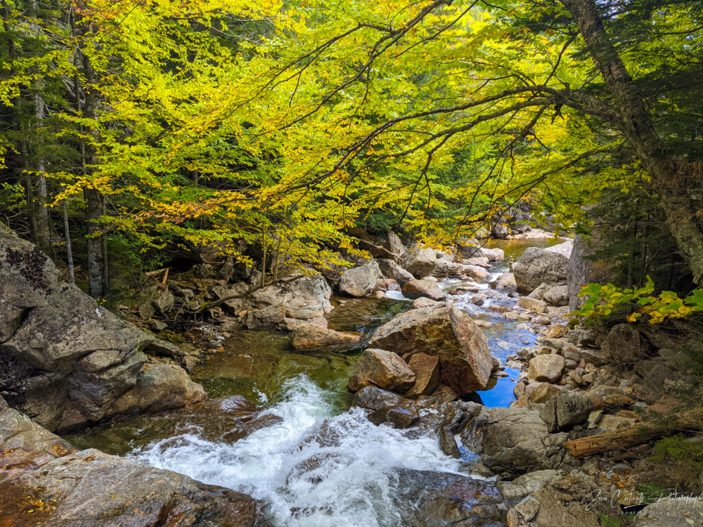
The Waterfalls Around Mt. Washington
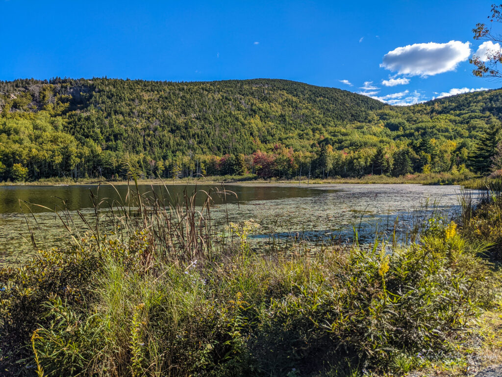
Waterfalls are one of my favorite natural features. Few things are more relaxing than sitting by a waterfall and listening to the soothing sound of falling water. There are many streams and waterfalls around Mt. Washington. As I do not have time for extended hikes, I will have to limit myself to waterfalls that are closer to the main road. Fortunately, I found three, all just short hikes away: Thompson Falls, Crystal Cascades, and Glen Ellis Falls
Thompson Falls
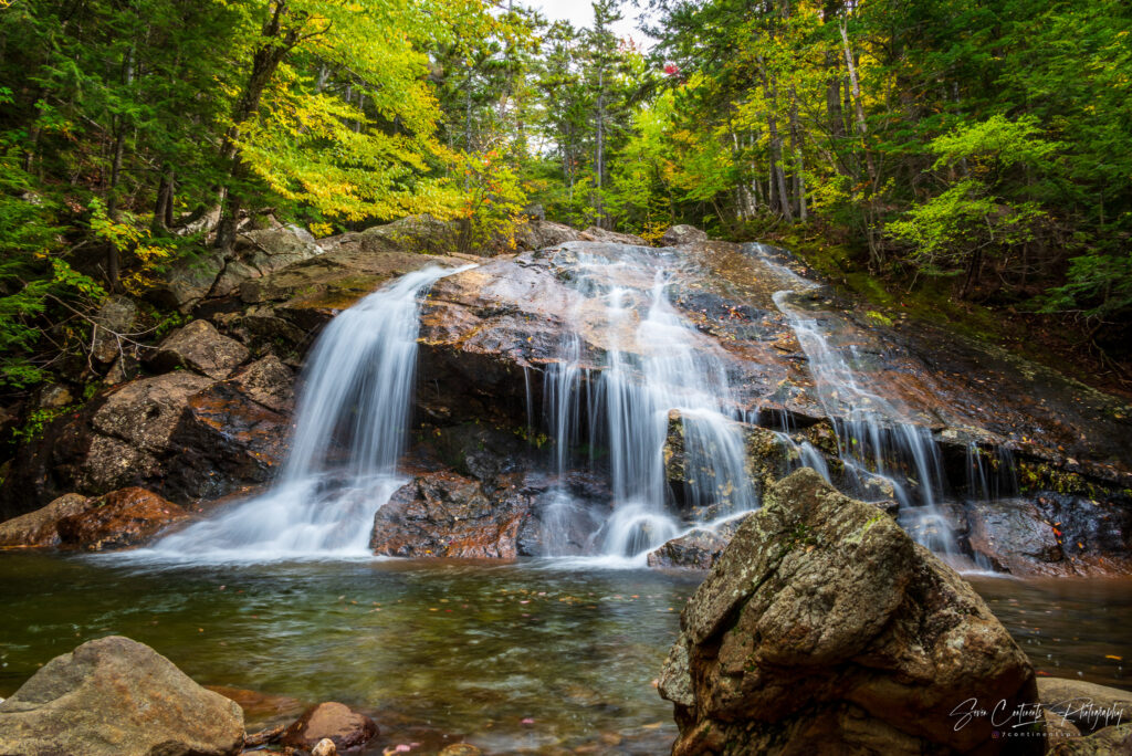
Thompson is a smaller waterfall close to the Wildcat Mountain ski area. Getting there involves taking short trail through the forest from the ski area parking lot. The entire hike takes only about 15-20 minutes each way. The trail is quite busy today and I encounter other hikers navigating the mostly easy trail. The only slightly challenging part is stepping across a small creek on the way. Shortly after crossing the ski area access road I can already hear the sound of the waterfall. I am in luck. The overnight rain storm that dumped snow on Mt. Washington also replenished Thompson Brook. Water covers the entire face of the waterfall.
Crystal Cascades
Crystal Cascades is a series of waterfalls on the Ellis River near the Joe Dodge lodge and the Pinkham Visitor Center, right off Highway 16. The hike on the Tuckerman Ravine Trail is short but steep. Not wanting to waste time, I rush up the hill until I cross a bridge and reach an even steeper trail leading up to a rocky observation platform overlooking the cascades. Out of breath, I meet an older couple from Long Island. The husband is kind enough to loan me his tripod so that I can take a better, longer exposure shot of the waterfall.
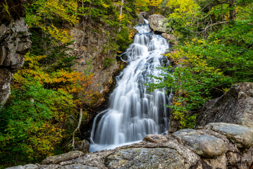
Glen Ellis Waterfall
The final and most scenic waterfall I will visit today is the Glen Ellis Waterfall. Parking for the trailhead is just a short drive away from the Joe Dodge Lodge but tends to sneak up on you. I had been here before a few years ago, but once again I miss the entrance and have to make a U-turn. The trailhead is a fee area – you have to put $5 cash in an envelope, tear off the receipt, place the receipt behind the windshield and drop off the envelope in a drop box. I am wondering how they make sure everyone completes the latter step, but I have the America the Beautiful annual pass, which covers the fee. No cash needed!
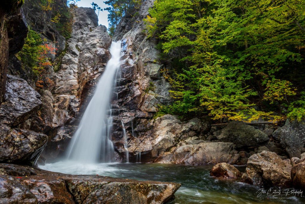
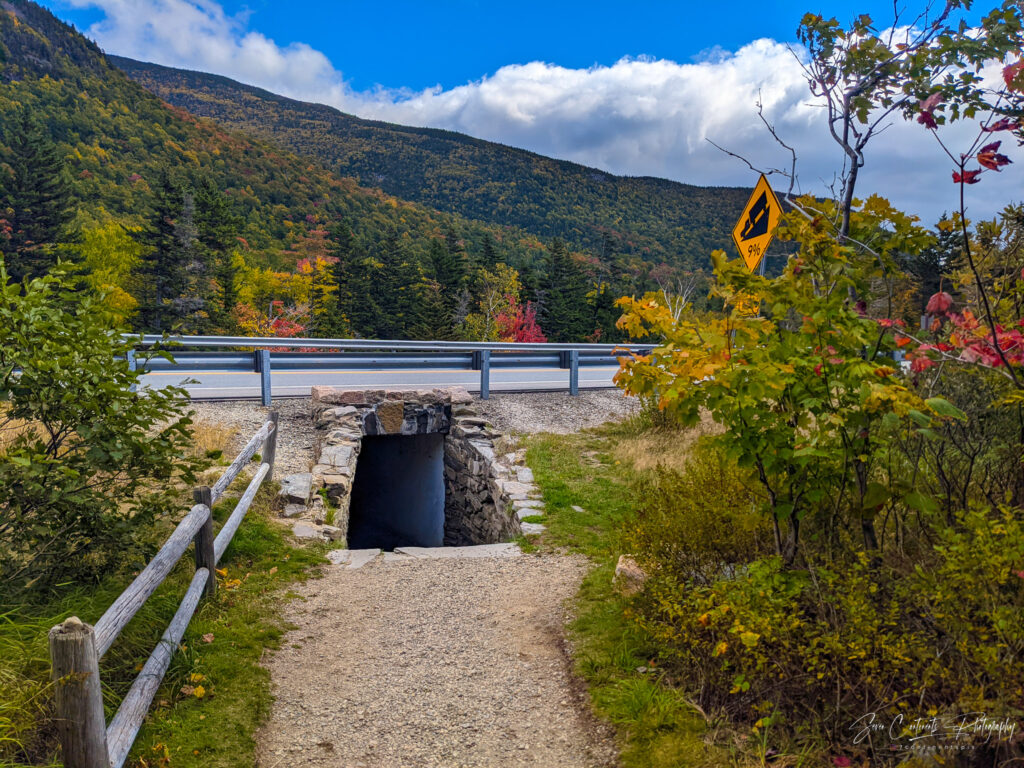
The trail takes you through an underpass under the road and along the Ellis River to the waterfall. There is an observation point above the falls and a second one below it. Getting below the fall involves climbing down some stairs be the hike isn’t overly strenuous. You can get an even better view climbing on some rock in the river itself, but they are quite slippery. During my last visit, I slipped and got my feet wet. I’m hoping not to repeat the same mistake this time. While I take some pictures, a lady with a camera joins me on the rocks in the river, her camera dangling precariously around her wrist. We exchange some photo tips and try to get the best shots. Unfortunately, I need to move on, so I bid farewell and return to my car.
Driving Home
Every trip has to come to an end and this is the end of my road trip. It’s a long drive to the interstate and I am lucky that the daylight portion of the trip involves lots of amazing scenery. It’s tempting to stop and enjoy every picture opportunity, but it is a seven-hour drive home to New Jersey. I’ll have to come back to see the sights of Saco River Valley.
nice post, keep it up
my god, incredible blog structure! The time span would you say you are right now publishing content to a blog for? you assembled publishing content to a blog look simple. The excellence of your internet based website is extraordinary, not to mention the material!
great work
Thank you for doing this!
Thank you for doing this!
Thank you so much Paulo! https://www.youtube.com/watch?v=d-aFr6axq7g&list=PLBW-spn8-AUk2Y1-XBFBQwB5TUy36R5Ty
Pets are great listeners. They may not be able to talk back, but they’re always there to lend a listening ear (or paw!).